On this page, you can create a .mapping file. The activities have been automatically loaded from the DFG.
Please provide lat, lon and y (height) values for each activity. This will determine the position of the activity
in the visualization.
1. Enter lat, lon and y values of the activities below. Tipp: You can obtain a lat/lon coordinate by right-clicking on any location in Google Maps.
2. When you are done, simply click on the button to generate a .mapping file. You can then download it and use it for your configuration.
You are seeing the editor for standard mode (no 3D map), because no 3D file was provided on the previous page. If
you HAVE a 3D map and want to create a mapping file for this, please close this window and make sure to provide the
3D file in the "configuration" page before opening the editor.
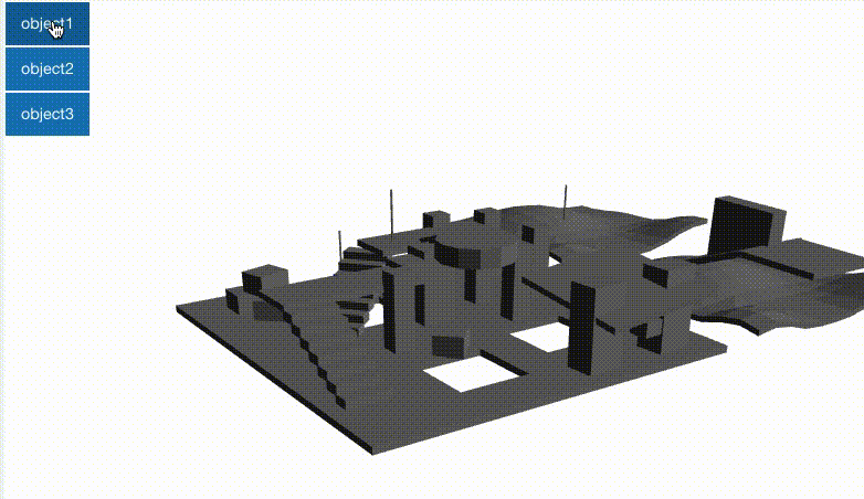
On this page, you can create a .mapping file for your 3D map. The activities have been automatically loaded from the DFG.
1.
Select an activity (blue buttons) and then click on a position on the map. This will save the position of that activity on the map. The corresponding mapping file (right) will be updated automatically.
i
Press and drag to orbit. Use mousewheel to zoom.
(2.) The JSON file will be updated automatically. You can then download it and use it for your configuration.
» Save Mapping File(Once downloaded, you can close this window)